


The digital transformation is increasingly reaching the utility sector and opening up new possibilities for making processes more efficient and sustainable. One particularly exciting task that can be greatly simplified by the use of digital technologies is tree mapping. Along power lines, roads and other critical infrastructure, it is crucial to accurately record the condition and location of trees. This is not only to take ecological aspects into account, but also to overcome infrastructural challenges.
By using robust technologies, utilities and municipalities can manage their tree populations more efficiently. Precise mapping helps to identify potential hazards such as overhanging branches or trees at risk of falling over at an early stage, enabling appropriate measures to be taken. At the same time, it ensures that the protection of the tree population remains guaranteed. This combination of efficient management and ecological awareness shows how digitalization can take the management of natural resources to a new level.
Digital solutions: the next step in tree mapping
Traditional methods of tree mapping are based on manual inspections and the analog documentation of data. This is not only time-consuming, but also carries a higher risk of error. Digital approaches use modern technologies such as GPS, LIDAR and geographic information systems (GIS) to accurately capture and manage data.
Strategies for adapting forests to climate change
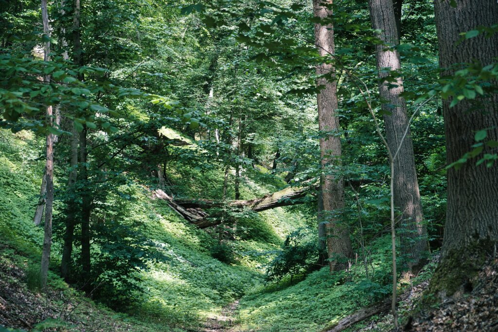
Forests worldwide are facing major challenges as a result of climate change: rising temperatures, changing precipitation patterns, more frequent extreme weather events and an increase in pests and diseases. To ensure the long-term stability and functionality of forests, adaptation measures are needed that are based on scientific knowledge and sustainable practices.
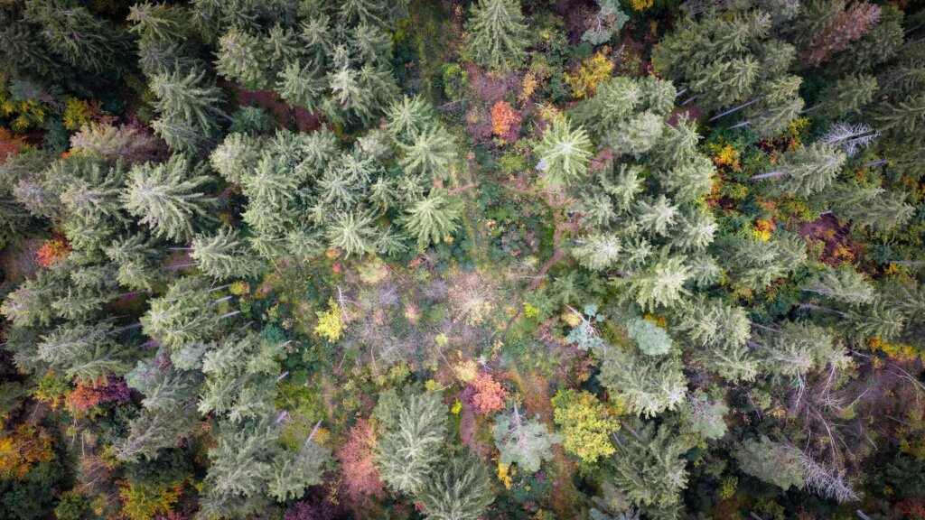
One important aspect is the recording of forest structure and tree species diversity. With the help of Lidar technology and drone recordings, high-resolution 3D models of forests can be created. These models show the height, density and distribution of the trees, as well as the soil conditions. Image processing algorithms make it possible to automatically identify tree species and assess their resilience to climatic stressors such as drought or pest infestation. This makes it possible to identify and prioritize particularly vulnerable areas at an early stage.
Another advantage of digital mapping is the combination of forest and climate data. By overlaying mapping data with climate models, risk zones can be identified that could be particularly affected by droughts, storms or pest infestations. These risk maps provide the basis for targeted adaptation measures, such as planting climate-resistant tree species or converting monocultures into mixed forests. GIS systems make it possible to simulate such measures and predict their potential impacts on CO2 sequestration, biodiversity and forest health.
Digital mapping not only improves forest planning, but also monitoring. Sensors and drones provide real-time data on soil moisture, tree health and other environmental parameters. This information flows directly into early warning systems that help foresters respond quickly to threats such as bark beetle infestations. In the long term, digital mapping also makes it possible to compare historical and current data to evaluate the effectiveness of measures and adjust them if necessary.
The efficiency gains from digital mapping are significant. Large forest areas can be mapped in a few days, whereas traditional methods would take months. The high precision of the technology ensures that even small differences in forest structure are detected, which is crucial for planning.
Overall, digital mapping is revolutionizing the adaptation of forests to climate change by providing precise data for targeted planning, implementation and monitoring of measures. It makes it possible to make forests more resilient to climatic changes while maintaining their ecological and economic functions.
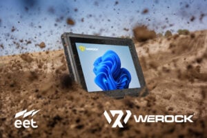
Added value through WEROCK products
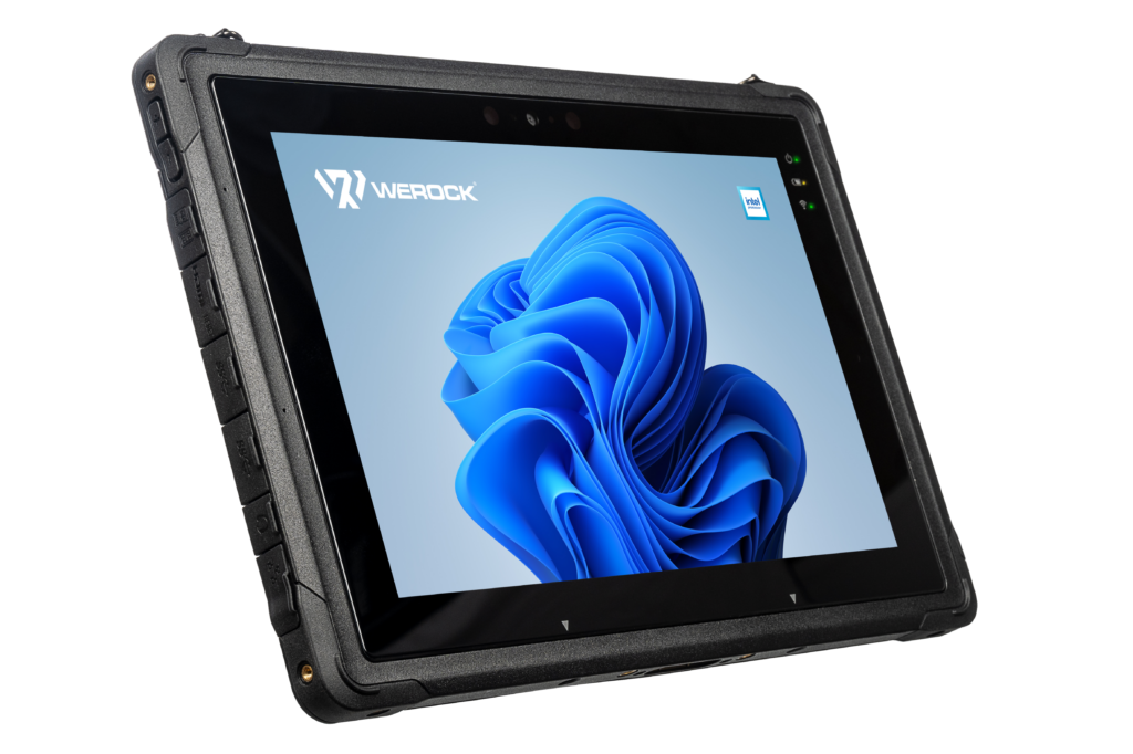
WEROCK offers more than just innovative software solutions – our hardware has also been specially developed for harsh operating conditions. Our robust tablets, such as the Rocktab U210 G2, are the perfect mobile companions for working in demanding environments. The Rocktab U210 G2 is a fully rugged tablet designed and optimized for outdoor use. It is certified according to the IP65 and MIL-STD-810G protection standards, which protects it from water, dust and shocks according to these standards. Its scratch-resistant screen exceeds the IK06 impact resistance and remains perfectly readable even in direct sunlight in the forest.
The touchscreen can also be operated with thin gloves, adapted to outdoor use. The Rocktab U210 G2 is also designed for extreme temperatures from -20°C to +60°C, so it works reliably on frosty winter days as well as in the blistering summer heat. With a battery life of up to 7 hours and the option to change the battery during operation, the device is perfect for long and demanding working days.
Alongside our robust devices, products such as the Ruxton Pack are also a valuable gadget. The Ruxton Pack is an ergonomic chest pack that has been specially developed for outdoor use with tablets. It allows for a comfortable and secure attachment of the device directly in front of the chest, leaving both hands free. The pack is equipped with a practical Velcro fastener that not only holds the tablet securely but also allows for quick access. Thanks to the MOLLE-compatible harness, the Ruxton Pack offers numerous expansion options for attaching additional pouches and holders. This means that tools, radios, water bottles and other equipment can be carried securely and always be at hand.
Conclusion
Digital mapping of trees is a prime example of how modern technology can make work more sustainable and efficient. It is an indispensable tool for effectively adapting forests to the challenges of climate change. By precisely capturing and analyzing data, it enables the targeted planning and implementation of measures that strengthen the resilience of forests and ensure their long-term ecological functionality. From identifying endangered areas to monitoring tree health, digital mapping not only increases efficiency but also provides a sound basis for decision-making in sustainable forestry and climate protection. It shows how technological innovation and ecological responsibility can go hand in hand to preserve forests as valuable habitats and climate regulators.
Increase the efficiency of your work and actively contribute to the protection of our planet at the same time!
Find out more about the Rocktab U210 G2 here.
If you have any questions or would like to know more, please contact us for a free and non-binding consultation.